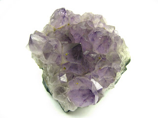
These granite outcrops are abundant in the southeastern United States. According to wikipedia, Panola mountain can be classified as Monadnock, or a granite-gneiss rock island. The outcrops in the US were created when the North American and North African continents collided. Specifically, Panola is comprised of quartz, feldspar, and muscovite.
Thursday, February 16, 2012
Rockin' it at Panola Mountain
Last weekend I traveled with my Conservation Biology class to Panola Mountain in Metro Atlanta. It is a nature conservancy with a large intrinsic granite outcrop. We traveled to see a pristine outcrop community including solution ponds and different stages of succession. This large outcropping had the soil weathered around it and was therefore exposed. Because it cooled below the earth's surface, it cooled slowly and was a medium-grey color. Panola Mountain is one of the only granite outcrops that has been preserved with very little human traffic (one must pay for a guided tour) and no commercial quarrying. It is a pristine environment.
Thursday, February 2, 2012
Thursday, January 26, 2012
Different maps
This is an example of a chloropleth map (states identified as republican or democrat in 2000 election):
This is a dot density map of people living with HIV/AIDS in Sub-Saharan Africa. Note the high density of dots in Malawi. I went there this summer!
This is one example of an isarithmic map showing Americans' stance on abortion:
This is another example of an isarithmic map showing Americans' political identification:
Ah. Wine. This is an example of a proportional symbol map. I'm going to Europe ASAP (just kidding).
Thursday, January 19, 2012
Google Map Work: Cruise to the Bahamas
I'm traveling to the Bahamas over Spring Break, and this is our travel plan. I placed a (messy) polygon over an area in the sand where there is hydrologic signs of the tides.
I hope it'll be fun!!
Subscribe to:
Posts (Atom)


